

Pitufa’s little cruising guide to the Gambier Islands–last updated Mar. 2019.
Some important points up front:
- Cruisers are required to check in with the gendarmes (even when they arrive from another French Polynesian island).
- The fees for rubbish (and optionally for water) must be paid at the town hall (mairie).
- Efforts to separate recyclable rubbish have started, so please use the separate bags for aluminium cans and glass bottles.
- Pearl farms have been extended and become more and more of a navigational hazard, so be careful!
(Text below from MAR. 2015 with minor updates)
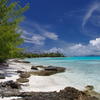
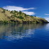
The Gambier Islands (Îles Gambier) are located at the southern fringe of the tropics, less than 300 nautical miles WNW of Pitcairn, SE of the Tuamotu archipelago and form the SE corner of French Polynesia. Some pilot books and cruising guides cover the Gambier Islands as part of Tuamotu. The islands are surrounded by a diamond-shaped outer reef with an 18nm-long N-S axis from 23°00′S to 23°18′S and a width of about 17 miles between 134°50′W and 135°08′W. While the outer reef is mostly submerged in the south and in the west, the northern and eastern side is a barrier reef with several motus on it. Inside the lagoon are four large, mountainous islands (Mangareva, Taravai, Aukena, Akamaru) and some smaller ones. Mangareva is the biggest island with the main village Rikitea.
The whole archipelago represents a small, but protected and diverse cruising area. It features motus (like the Tuamotus, but without the need of entering tricky lagoon passes and some motus are covered with pine trees…), mountainous islands with well-sheltered anchorages (even though catabatic winds can make some anchorages quite gusty) and plenty of shore activities, beautiful bays and beaches, a lovely town (Rikitea) with minimarkets, bakery (fresh baguettes for breakfast!), restaurants, medical center and friendly, hospitable people. The pristine underwater world offers superb snorkeling and diving possibilities (there is ciguatera though, so don’t catch fish–only watch them).
We arrived at the Gambier islands for the first time on May 17th, 2013 (an El Niño-neutral year), after a 24-days passage from Isabela, Galapagos (distance 2900 nm). We slowed down on our last day to avoid arriving at night. The entrance via the west pass was no problem, since it is well marked (IALA buoy system A like in Europe, so leave red on your left when coming in…), wide and deep (Pitufa’s draft is 2.20 meter). South of Mangareva we experienced strong headwinds and choppy waves (which made our previously squall-washed, salt-free deck totally salty again)–Mt. Duff creates a noticeable acceleration zone here. Turning north, a shallow, but nevertheless deep enough gap in the bank between Mangareva and Aukena needs to be crossed. The French charts are detailed and accurate, so theses passes and channels are easy to navigate. We use Navionics, CM93 2011, and Garmin Bluechart charts and found them mostly reliable. We will mention some inaccuracies further below.
Cruising Guides
We found that the classic, printed guides (Charlie’s Charts of Polynesia, South Pacific Anchorages, Guide to Navigation and Tourism in French Polynesia) provided only little information and were relatively outdated. The most useful source for us was Soggy Paws’ compilation ‘The Tuamotus Compendium,’ which can be downloaded from http://svsoggypaws.com/files/.

Gambier leaflet (click for larger image)

Climate chart (click for larger image)
Weather
Between June and September it is Winter. Really! (Okay, no snow of course, but for the tropics it gets rather cold.) According to the Gambier leaflet, which we got at the mayor’s office in Rikitea, the coldest months are July, August and September with average peak temperatures below 22°C and average minimum temperatures around 19°C (see image to the right). The frequency of depressions moving by further south increases to at least one per week. Each such system shifts the wind direction counter-clockwise around while it passes by and sends fronts with lots of rain and squalls. The wind roses (see images below) do not show much of a prevailing wind direction during those winter months. Southerly winds bring chilly air masses. The water temperature dropped from 26°C in May to only 21°C end of July.
We left the Gambier at the beginning of August after many weeks of waiting for a weather window to sail north to the Marquesas. The many frontal systems allowed only for very short windows and the mood on Pitufa got worse since we were really stuck on the boat. It was too rainy for hiking, too cold for snorkeling, too splashy for dinghy rides. We learned not to make any elaborate plans anymore, but to spontaneously use the rare and short, calm and sunny periods for activities.
The Gambier islands are surely a little paradise and we are glad we came here, but we definitely did not expect the weather to be so bad around July. So we can only recommend to visit these islands either early in the season and move on already in June or to consider coming here in the southern-hemisphere summer, which is in the cyclone season. We did the latter and returned to the Gambier islands in the beginning of November 2013 and again for the cyclone season 2014/15. November had still a few massive fronts that got stationary around the area and so brought cold and rainy weather for several days. Really beautiful and hot weather started with the beginning of December. The water temperature was already up around 25°C when we arrived in November 2013 and climbed to around 28°C in December. January and February were still hot, but in March the temperature dropped noticeably again. (according to locals that was very early in the year… In the following year (2015), we had beautiful and hot weather in March.) Summer is ideal to explore the archipelago as there’s only little swell and exposed anchorages are an interesting option.
March (click for larger image)
July (click for larger image)
December (click for larger image)
Anchorages
Rikitea, Île Mangareva
The marked entrance to the anchorage off Rikitea runs along a curved channel. It took us a bit to get used to the scale (the legs between the marked gates are shorter than we thought) and to figure out that the first red marker was actually missing… (it was replaced later). When the big supply ships manage to go in and out here, it shouldn’t be a big deal for a small yacht either.
The anchorage is well protected from the waves (particularly further N behind the reef marked with cardinal signs), but open to the prevailing winds. It is big enough for at least 30 boats. The depths are around 14 to 20 m and the holding is superb. The situation only gets tricky when the anchorage is packed with boats and strong gusts howling down the mountains start shoving them into different directions (usually when there’s a strong wind blowing with a westerly component).
Dinghy docks
There are several possibilities to leave the dinghy. The best-protected option is to leave the dinghy on the floating pontoon of the main pier in the southern end of the anchorage. Further N is a concrete wall to tie up to in front of the bakery–only short term, but handy when you only want to pick up baguettes or do some quick shopping. There’s another big pier on the northern end of town (the multi-purpose hall is just behind it) that is quite popular with cruisers, but it can get a bit rough there in winds from the SE. The public garbage bins are located there and the recycling bags as well.
Gendarmerie (check in), Post office
Walking south from the main dock on the main road you walk by the “Mairie” (mayor’s office), where you can get an info brochure with some history and walks described. The Gendarmerie is located on the same road (theoretically open from 7 to 4 with a lunch break between 1 and 3, but the opening hours seem to vary a bit…) and entry formalities can be done here. For EU citizens there’s not much bureaucracy involved: the gendarme wants to see passports and ship’s papers (he wasn’t interested in insurance papers or the zarpe from the last port), we filled in the customs-declaration form and were told to send it to Tahiti. We were told to report to the custom’s office on arrival in Tahiti, unless we were visited by the custom’s boat ahead of that. According to current regulations (new in 2014) EU citizens can stay in French Polynesia unlimited without visa, but have to pay import tax on the yacht if they stay longer than 3 years.
Non-EU-citizens can stay 3 months with a visa, but have to pay a bond (unless they arrange their visit via an agent).
You can easily spot the post office from the anchorage, it’s the building with the big satellite dish and high antenna. The post office is open Monday to Friday from 8 to 4 (no lunch break), you can change USD or EUR for French-Polynesian Franc there (there’s no ATM on the island!).
Minimarkets and food
Each year the situation changes, snacks and little shops open and close again, so we only mention the bigger ones here that have been operational for a longer time. Walking up the main road to the right you reach a minimarket with an attached bakery. The bakery sometimes accepts reservations, sometimes it’s first-come-first-serve system. It’s only open around 5 in the morning and around 3 in the afternoon–that’s when the baguettes get out of the oven and can be picked up warm. The shop next door is usually open from morning till evening without lunch break, on Sunday’s it’s closed during church and in the afternoon. Walking further north you’ll see Jojo’s, another small shop on the right hand side with a little restaurant (lunch only) attached. The Pizza place is yet further up the road (just before the multi-purpose hall), where you can eat really good pizza (open Friday to Sunday from 17.15).
If you take the main road to the left (south) coming from the main dock you’ll find the biggest mini-market on the left hand side (it’s a bit set back from the road under a big tree). Walking further south past the Centre Medical and the Gendarmerie you’ll see the Terehere shop on the right (they have a little hardware compartment), and a little minimarket next to the Air Tahiti building further on.
The prices seem to vary quite a bit, so it pays off to make some comparisons. The red-labeled prices are subsidized by the state and usually the cheapest.
The shops are stocked with basic food, but even these items can run out when the supply ships arrive with delay. After the arrival of the supply ship you have to be quick to get fresh vegetables (cabbages, potatoes, carrots, sometimes tomatoes, apples, cucumbers, or even grapes) and fresh dairy products. The vegetables in the markets are sometimes half-frozen when they arrive and don’t last very long. Local produce isn’t available in the shops, but when you talk to people and make friends you’ll find that many grow their own fruits and veggies and are willing to give some away for free or to trade veggies for not so readily available goodies (rum’s precious in French Polynesia). This way we got pamplemousses, lemons, papayas, bananas, manioc, reddish, breadfruit, tomatoes, green peppers, pok choy, lettuce, string beans, etc.
There are several local chicken batteries that supply the shops, so fresh eggs are usually available.
Other services
Fritz the German lives in the blue house at the northern end of the anchorage. He came here with the foreign legion about 30 years ago, stayed and runs an open house for yachties. He has a washing machine and ishappy to have some company, but speaks only French and German.
For small amounts of gasoline you can ask locals or try at the minimarkets (e.g. Jojo’s), diesel is available in 200-liter barrels directly from the supply ships. Yachts can also go alongside the supply ship to fuel up from the pump hose (you have to take at least 200 liter, it’s best to phone the Taporo or Nuku Hau office ahead to make a reservation).
Snorkeling
Interestingly enough, you don’t have to go far to find good snorkeling spots. Just outside the anchorage off Rikitea you find a beautiful coral garden with plenty of fish.
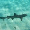
The fish are generally big and not scared of divers. The reason for this behaviour is a disease that occurs quite often in subtropical and tropical waters: Ciguatera. Microscopically small Dinoflagellates containing ciguatoxin live on the reefs. The toxin is harmless for fish, but accumulates in individuals and along the food chain (big predators that feed on reef fish contain especially large quantities. Ciguatoxin’s extremely dangerous for humans and other mammals. It’s a neurotoxin and the symptoms reach from nausea, tingling sensations in the limbs to cramps and death. People who survived a strong case of ciguatera may suffer from it for the rest of their lives. Locals know which fish are safe to eat, but the safest solution is not to eat any fish caught in the lagoon. That’s bad for the menu on board, but guarantees a marvellous underwater world!
Walks
Mangareva is great for hiking. A partly paved road leads around the island (leaving out only the mountainous southern tip) and you can do nice round trips via the two ‘Chemin traversier’, the pass over the saddle and the coastal mainroad. The hiking tracks were reasonably well maintained when we were there.
Round-trip Kirimoro: Walk up the chemin traversier Kirimoro (dirt track opposite the shop with the restaurant clearly marked by a sign) that leads you through a beautiful forest up the ridge and down again to the westcoast of the island. Walking left you then follow the coastal road along the turquoise lagoon. When you reach a crossing take the left road that leads you up the saddle (there’s a viewpoint on top, follow the sign “Belle vue”) and back over the saddle to Rikitea (ca. 2-3 hours).
Round-trip Taku: Walk north along the coastal road, until you reach the chemin traversier Taku (marked by a sign). The track also leads you up the ridge with great views of the anchorage. When you reach the mainroad on the other side, walk right. You’ll soon reach the abandoned village Taku with its pretty church. The main road leads then to the northern cape of the island (two marked viewpoints) and back along the eastcoast to Rikitea (ca. 4-5 hours).
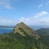
Mount Duff and Mokoto: Walk left from the main dock and up the main road to the pass (viewpoint “Belle vue” on top). Descending on the other side you’ll find the clearly marked track to either Mount Duff or Mokoto. The first part of the track’s the same for both mountains, approximately a third of the distance up you’ll reach a sign that leads you either left up Mount Duff (slightly higher, steep, but not difficult unless it’s muddy and slippery after a rain) or on the right to Mokoto (slightly steeper). From both peaks you have incredible views all over the lagoon and the islands. It takes 1/2 hour to get to the beginning of the track and then 1.5 hours up to the top.
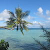
Île Taravai
The charts around Taravai are generally detailed, only the southern side of the island is uncharted. Also, some of our Garmin detail charts were offset. There were some minor chart inaccuracies, such as W of the village around 23°08.97′S 135°00.38′W where it has 9 m instead of the charted 20+ meters, but otherwise the depths were either deeper than or the same as charted.
The water clarity around the west pass and W of Taravai was incredible: coral in 15 m depth seemed only a sleeve length away. Such visibility invites to go diving and snorkeling.
Taravai has beautiful, uninhabitated bays on the western side: Baie Anganui and Baie Onemea. After being in Rikitea for a while, where the sun merely disappears behind the mountains, in those two western bays proper sunsets can be enjoyed again. We heard reports that thick swarms of mosquitoes befouled these beaches, but we cannot confirm those reports, even though it rained a lot at times when we were there. Flies might be a nuisance (not only here but all around Taravai).

(click for larger image)
Baie Anganui
We approached from the N and anchored at 23°08.739′S 135°02.947′W in 13-15m depth in sand with good holding. The bay has 2 long sand beaches in the E and SE and some smaller ones in the S, separated by rock formations. Dinghy access may be difficult at low tide as we haven’t found channels through the coral reefs. At high tide it’s no problem to go straight over the coral. We found the sand at the long beaches very soft, sinking in with every step, so we preferred the smaller beaches S with firm, white coral sand. Once we hiked up the ridge S, however, there are no paths (only goat tracks that disappear under the shrubs), so you have to make your own path. What looked like grass to us from the distance, turned out to be 2m-high reed.
The snorkeling was great around the reefs further out of the bay. Closer to the beaches, the visibility decreased. There were many curios black-tip reef sharks. Close to the beaches, baby reef sharks patrolled back and forth.
Baie Onemea
This is one of our favourite anchorages in the Gambier islands. Approaching from the N via Baie Anganui is easy through the deep channel close to the shore. See the screen shot below with our tracks. The sandy area to anchor between the reefs is larger than shown on the charts. (Double-check with satellite imagery.) We dropped the hook at 23°09.022′S 135°03.311′W in 6-8m sand with good holding. On our Garmin, the chart was offset.
The two beautiful beaches with golden and reddish sand are easily accessible at any tide through sandy channels. Also here we hiked up the ridge to the S. Plowing through the shrubs, reeds and ferns was strenuous, but the view over the bay as well as over to the S of Taravai and Ile Agakauitai was stunning.

(click for larger image)
Anchorage between S of Taravai and Ile Agakauitai
Unfortunately this area is uncharted, but satellite imagery reveals the reefs and shows how big the sandy area to anchor is. We approached from the S to the waypoint 23°10.108′S 135°02.581′W. This location is close to the rocks and at times with big swell waves break on both sides of you. From this waypoint we kept a straight bearing towards the house ashore at 23°09.349′S 135°02.273′W. There is one shallower patch with around 4m depth on the way in before reaching the large, coral-free area for anchoring. We anchored around 23°09.63′S 135°02.28′W. See the screenshot below with reef outlines (thanks to Mark on SY Irie!) and our tracks. The anchorage is well-protected from all sides but SW, from where some chop may build up. At times with stronger winds, particularly when the wind has a northerly component, it can be very gusty. Once we measured 50kn while it was blowing 20-25kn from the N elsewhere.
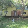
In the house in the southern bay of Taravai, Eduard and Denise made their little paradise. They are used to visits by cruisers, have a guest book and Denise sometimes sells veg from their garden.
There is also a house on Agakauitai. It’s idyllically placed behind the beach in front of the cliff, however, it’s not permanently inhabited and the owner doesn’t want people to walk around on his property.
Village anchorage
There used to be three small buoys to mark an entrance about 250m NE of the tiny islet Motu-o-ari. (You were supposed to leave those buoys closely to your port side when going in). In case those buoys have not been reinstalled, you may follow these waypoints:
Approach from the east.
WP1 S23 08.954′ W135 01.111′
WP2 S23 08.944′ W135 01.149′
WP3 S23 08.927′ W135 01.175′
WP4 S23 08.902′ W135 01.193′
WP5 S23 08.912′ W135 01.230′
Once we had only about 1m under our keel (2.2m draft), so it gets pretty shallow. For anchoring we cannot recommend the shallower (6-10m) fringe area of the basin as there is only a thin layer of sand on coral plates with bad holding. In the deeper area (15-20m) of the basin the holding is better. We often anchored close to Motu-o-ari around 23°08.95′S 135°01.36′W in good-holding muddy sand.
Be aware of the many corals in this anchorage and also of debris such as submerged buoys and lines from abandoned pearl farms. In strong E winds this anchorage gets very bouncy. For N winds it is best to anchor in the northern basin S of the tiny islet around 23°08.6′S 135°01.49′W in about 15m depth in good-holding muddy sand.
The village consists of a church with manicured gardens and a handful of houses. Only two houses seem to be permanently inhabited: Herve, the caretaker of the street and church, lives at the northern end of the village with his wife Valerie and kids Alan and Ariki. The friendly couple is used to having cruisers around and speaks English. They organise BBQs (cruisers are welcome, but should generously add to the buffet!), sometimes they sell veg and Herve takes hikers up the mountain. As Polynesians they are obliged to drop everything whenever visitors arrive so keep in mind that they’ve got work to do as well and don’t overstrain their hospitality.
There is a hiking trail connecting the village and the bay in the S (at least 1h one way). Ask for directions. For a not too difficult side trip with great views, you can follow up the SE ridge (mostly under pines) to a peak overlooking the village and lagoon (add another hour for this detour).
Île Aukena
Aukena cannot be approached directly as thousands of buoys for pearl farming block the way. We were told to stay in a narrow channel between the buoys and the reef that connects Mangareva and Aukena. Don’t rely on the charts here but use your eyes! A chart inaccuracy seems to be around 23°07.90′S 134°55.46′W, where we navigated even closer to the reef to avoid a wrongly charted coral head as well as the many buoys. The buoys reach very close to the reef so you have to wiggle through at some places… A further complication’s the fact that new buoys are set continuously (on the way back we wanted to follow our GPS track which had been blocked by a new set of buoys in the meantime…) As soon as you’ve reached Aukena you can sail further up north hugging the coast closely. Take great care to navigate around the numerous coral heads along the shore of Aukena.
We stayed rather S and anchored at 23°07.962′S 134°55.027′W in good-holding sand. However, anchorages off the southern part of Aukena can be somewhat rolly. Better spots can be found further NE just above P.te Puirau.
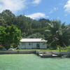
The church of St. Raphael can be found in the southern part of Aukena. Antonio, who takes care of the church and its surrounding gardens, lives alone in the small house at the beach and always appreciates company. Whenever we came by he gave us dozens of Papayas.
Further NE, in the middle of the island, the house of Bernard and his family is nicely located behind the long beach. Bernard prefers when cruisers ask for permission prior to anchoring off his beach close to the house.
The northern part of Aukena is privately owned and visiting yachts are not welcome.
Île Akamaru
To navigate into the inner lagoon N of Akamaru, your boat must draw less than 1.4m (clearly we did not go there). Best to ask other cruisers who have been around the islands for a while for the way in.
We anchored about 0.5nm N of the small island Mekiro in the still deeper basin at 23°09.993′S 134°55.237′W. The charts are not much use here and coral heads are numerous. Yachts foul their anchor chain here frequently. We used fenders to float our chain.
On days with little southerly swell (<1.5m according to meteo.pf, i.e., 'fr.poly' from saildocs.com) anchoring is also possible west of the gap between Mekiro and Akamaru. We anchored on a sandy patch around 23°10.77'S 134°55.45'W in less than 10m. From here the dinghy ride to the village is shorter than from the basin N of Mekiro.
Somewhat further S on the W side of Akamaru at 23°11.228'S 134°55.522'W is another sandy area for easy anchoring. There is a large, single bommie at 23°11.20'S 134°55.51'W, but the area around that bommie is big enough for 3-4 boats. This anchorage might be an option when you arrive through one of the S passes during the night.
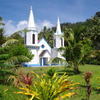
The village of Akamaru on the N side features a pretty church, manicured houses and gardens and a handful of friendly people. It's almost too kitschy-perfect to be real ![]()
A hike to the top of Akamaru offers beautiful views. We recommend to dinghy S along the W side of Akamaru, where the ridge has it's lowest point. From there follow the ridge N all the way to the top. Bring a sun hat as there is no shade along the trail.
Île Totegegie
Totegegie is a long and narrow motu on the eastern barrier reef, the airport of the Gambier islands is located on the northern part (usually one plane arrives per week, during the summer two).
Be aware of pearl farm buoys when navigating up to Totegegie. We encountered buoys even in the charted channel N of Aukena.
You can anchor off the tiny harbor at the airport, for instance at 23°05.034′S 134°53.356′W in 8m sand (convenient when picking up or dropping off visitors) and further east in a sandy basin after the cleared area of the airport. We anchored in that basin at 23°05.815′S 134°52.631′W in 14m depth with good holding.
We experienced that the holding in the shallower areas of the basin was poor as the ground there comprises of coral or rock plates with only a thin layer of sand on top. The water along this motu has a high coral-sediment content which causes bad visibility and a strong turquoise coloring.
Keep in mind when navigating here that depths between around 4m and 20m show about the same color.
Close by the basin anchorage there’s a cut in the outer reef that’s a popular snorkeling spot. When the tide is high enough you can take your dinghy out through this tiny pass (e.g. for a drift snorkel).
Tauna and other motus
A great deal of eye-ball navigation is necessary to go to the smaller motus, particularly to the ones further N of the airport. It is a good idea to talk to cruisers who have been around the Gambier for a while and they might be able to provide you with GPS tracks.
Anchoring off Puaumu may be tricky as sandy spots between the countless coral heads are small. Many of those coral heads reach up to the surface. We highly recommend to either buoy your anchor chain or to use a Bahamian mooring to avoid fouling your chain and damaging corals. One of our anchoring spots there for N winds is at 23°01.146′S 134°55.294′W in 6m with all bommies deep enough within swinging room. For E-NE winds we prefer to anchor at 23°01.226′S 134°55.147′W in 4.5m.
The approach of Tauna to the east is relatively straightforward and several nice anchoring spots can be found in well-holding sand with good protection in easterly winds. Important: don’t anchor in the deeper water as there are many bommies–mostly with live coral! We have to watch yachts every year again with their chains wrapped around the coral heads and getting stuck. It’s best to anchor on the sandy shelf in 4 to 5 m depth north of the motu. Tauna is one of the few places left with healthy coral (beautiful snorkeling!), so be careful not to do any damage there! The long sandbank that extends Tauna to the S regularly gets washed away by storms (but it slowly comes back again).
Tekava, 1 nm south of Tauna, has a sandy spot around 23°09.785′S 134°51.29′W. We anchored there only for a quick daytime visit as it was too rolly to stay overnight. It might be okay there in calm conditions without much southerly swell.
For the infrequent periods of W-NW winds (or in dead calms of course), visiting Motu Tenoko just N of the NW pass is a nice alternative. The approach from the S is straightforward and a good anchorage can be found on the large sandy area S of the motu at 23°04.649′S 135°00.751′W in 4-5m depth.
We can recommend snorkeling right SW of the anchorage along the many narrow sandy channels through healthy coral, clear water and plenty of fish.
Our GPS Tracks
Photo Galleries
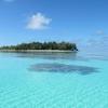
Iles Gambier: Motu Puaumu
Hanging out at Motu Puaumu in the north feels like being in the Tuamotus, but the high islands with their protected bays and lush mountains are just a few miles away.
(28 photos)
Iles Gambier: Mangareva
We arrived in the Gambier Islands, French Polynesia, towards the end of May 2013 and were enchanted by the lush island of Mangareva and its pretty town Rikitea.
(28 photos)
Mangareva, Part 2
After spending more than two months in the Gambier, our first gallery about the main island Mangareva felt somehow incomplete. Here are some more impressions of this lovely island, the hikes we did, the friends we made (human and canine) and the daily life in the village Rikitea and in the anchorage.
(40 photos)
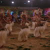
July Festival in Mangareva
When we arrived in Rikitea in May, we already heard drumming each evening. Two competing dance and drumming groups spend several months preparing for the highlight of the year: the 'Le Juillet' or 'Heiva' festival with daily traditional dance performances and fringe events takes place between the 5th and 14th of July. In the end prizes in different categories (best Mangareva dance, Tahitian dance, single and pair dance, drumming group) are awarded. The festival turned out surprisingly tame, maybe due to the fact that no alcohol was sold.
(50 photos)
Gambier's underwater world
The Gambier feature pristine coral reefs and abundant fish in crystal-clear water. The fish grow generally large and are not shy since nobody hunts them because of Ciguatera (a nerve poison from an algae that accumulates in fish without harming them). All pictures were taken with our small, waterproof Canon Powershot D20 while snorkeling. The dropping temperatures (water temperature in May still 26°C, in July only 22°C) prevented us from exploring more snorkel or dive sites.
(30 photos)
Ile Taravai, Iles Gambier
We visited Taravai, the second biggest island in the archipelago, in June 2013 and instantly fell in love with it: rugged mountains, pristine corals, remote bays, beautiful beaches, and only a handful of friendly people.
(50 photos)
Our house on Taravai, Iles Gambier
During the cyclone season 2013/14 we stayed a while in a little house on our favourite island in the Gambier. Living ashore in the tropics turned out to be a hassle, an adventure, but also a worthwhile experience.
(46 photos)
Interlude as landlubbers
During the cyclone season 16/17 in the Gambier Islands we stayed as house-sitters on Taravai. The Polynesian owners Edouard and Denise live in Tahiti and are happy to have somebody looking after house and garden.
(60 photos)
Akamaru, Gambier Islands
In 2015, during our third visit to the Gambier islands, we finally made it to Akamaru. Its anchorages are a bit inconvenient, but this lovely island is definitely worth the effort.
(24 photos)
Ile Totegegie et Ile Aukena, Iles Gambier
The crystal-clear waters and good charts make exploring within the protected lagoon of the Gambiers easy. At the end of June 2013 we took Pitufa up to the airport island Totegegie and then on to Aukena, the 3rd biggest island in the archipelago.
(26 photos)
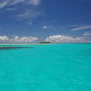
Motu Tauna, Iles Gambier
On the barrier reef in the very east of the Gambier archipelago, the tiny motu Tauna seems to float in a symphony of colours.
(36 photos)
The south-west corner of the Gambier lagoon
In January 2014, during totally calm weather, we spent a magical day anchored just behind the south-west barrier reef.
(8 photos)
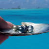
Gambier Islands--Home of the Black Pearls
All around the world they are sold as 'Tahiti Pearls', but in fact most of the famous black pearls are grown in the lagoons of the Gambier and the Tuamotus. We visited Eric's pearl farm and Rikitea's engraving school in March 2015.
(27 photos)
Published Articles

Birgit Hackl, Christian Feldbauer: Iles Gambier — Südseeparadies am Rande der Tropen. Teil 1, OCEAN7 03 (May/June) 2014, p. 24–27. download PDF (in German only)

Birgit Hackl, Christian Feldbauer: Iles Gambier — Südseeparadies am Rande der Tropen. Teil 2, OCEAN7 05 (September/October) 2014, p. 24–29. download PDF (in German only)

Birgit Hackl, Christian Feldbauer: Die schwarzen Perlen der Südsee, OCEAN7 05 (Sept./Okt.) 2016, p. 44–48. download PDF (in German only)
For further information check out our blog entries in the archive from May to August 2013, from November 2013 to April 2014, from December 2014 to April 2015, from December 2016 to May 2017, from January to April 2018, and from January to April 2019.
Donate
If you find our guides useful you might want to buy us a drink when you meet us somewhere around in person or make a donation to our PayPal account.


9 comments
Poul Hansen says:
March 17, 2014 at 2:09 pm (UTC 0)
Hello
I’m looking for windstatistics for the Tuamotus and would like to know where You got Your QUIKscat diagrams. I can’t find any historic average information on their side.
Thank You
Christian says:
March 17, 2014 at 4:54 pm (UTC 0)
Hi Poul,
go to this site of Oregon State University: http://cioss.coas.oregonstate.edu/cogow/
There is an interactive ocean-wind atlas with links to their wind roses. You also might be interested in our kml file for google earth: https://www.pitufa.at/2010/12/prevailing-ocean-winds/
Poul Hansen says:
March 23, 2014 at 12:43 am (UTC 0)
Thank You
I’ll look at it.
Tuuli says:
April 2, 2014 at 3:16 pm (UTC 0)
We are leaving for Gambier on April 4, 2014 from Ecuador. Thanks for taking the time to post this comprehensive information.
Birgit says:
April 4, 2014 at 4:52 pm (UTC 0)
Fair winds, good fishing and cu (kind of) soon!
Roger & Sasha says:
January 11, 2015 at 12:21 am (UTC 0)
Hi guys,
Gambier sounds like it’s right up our ally, especially the lack of crowd. After 8 1/2 years of cruising we are ready to spend few years in the Pacific. Now in San Blas.
Love the info on your website. A couple of questions. How did you manage to rent a house? We are into kiteboarding, sounds like you had some breeze in the summer, when we hope to be there 2015/16, could you give us a rough idea of percentage of time when it was blowing more than 15kts during the summer?
Christian says:
January 11, 2015 at 1:48 am (UTC 0)
Hi,
hm, do you mean southern or northern hemisphere summer?
In northern hemisphere summer (here winter) you gets loads of wind, but on the extremely chilly side
Southern hemisphere summer last year was really hot and sunny with some very calm days, but the kite surfer crowd that visited had a good time with easterlies around 20 knots. They thought most of the beaches were a bit tricky for kitesurfing, as there are shallow coral banks, but there’s also some ideal sandbanks on the motus.
This year summer’s a bit cool and rainy (maybe due to the light El Nino), but you’d have enough days with strong winds.
We found our house just asking around, there’s many locals who spend some time in Tahiti and might let cruisers ‘house-sit’. Our house is one of the seldom used weekend houses (there’s many of these in the half-abandoned villages on Akamaru and Taravai).
Enjoy the San Blas and cu maybe in the Gambier next year!
the smurfs
Stephanie Kirkcaldie says:
November 9, 2015 at 6:58 am (UTC 0)
Beautifully represented ,Thank you
Karen Birkett says:
February 19, 2021 at 6:46 am (UTC 0)
Dont know if you will ever c this as its now 2021. I LOVED reading about (and pics!) the Gambier trip. Im not a sailor but wish I was, your life is amazing. Im curious about the kitty. Was she your sailing cat or did u find her there? She seems like a really neat cat. I worry about all the strays even the piggies. Theyre amazing smart animals.
Your kitty could have an adventure blog. I realize this trip was years back but I hope shes still adventuring with you. She looks just like my girl manx torti shell cat. Vocal, people loving cats.
Anyway, thanks for sharing your adventures for those of us living vicariously thru them.
Karen