Yesterday evening we left Nengonengo and are now approaching Raroia in nice conditions. 8 nm to the pass!
2019
13
May
2019
12
May
Rekareka
We reached Rekareka this morning and have managed to anchor despite 15-20 knots of wind, about 2 m windseas from the E and a 2m swell from the S. It’s suprisingly calm (but still rolly) at the western side of this tiny motu and we have a beautiful view of lush motus with many palmtrees, but also lots of shrubs and leaf trees. Different kinds of terns and boobies have flown by to check us out, but unfortunately we won’t be able to go ashore–just impossible with the high swell breaking on the outer reef…
We’ll stay for the day and do some snorkeling before we head on to Raroia in the evening.
2019
12
May
Great forecast
We left Nengonengo this morning with what with thought perfect timing in the pass (and got crazy high standing waves) in perfectly stable weather conditions (no cloud in the sky, great forecast)–since noon we’ve had one squall per hour. Good sailing, too much wind, reefing down, rain, wind gone and the same again and again.
2019
10
May
Nature paradise Nengonengo
There’s a warning for high swell and therefore strong currents in passes, so we still haven’t left Nengonengo. Instead we did a snorkel in the pass yesterday, were sucked out high speed with the current, marveled at fat grey reef sharks, a big nurse shark, numerous white and blacktip reef sharks, napoleons and swarm fishies in incredible numbers–absolutely fabulous. We just had to be careful to hop back into the dinghy before we drifted into the area at the exit of the pass where the standing waves started (wind against a strong current makes for impressively high waves…). We did this trip a few times as it’s a short pass.
Today we took the opportunity to explore the northwestern and western motus by dinghy. After a one mile ride across the rough lagoon we walked a few kilometres down the western motus and were positively surprised to find large nesting colonies of frigate birds, many red-footed boobies who are just courting (they don’t dance like their cousins the blue-footed boobies, but ‘sing’ instead, or rather roar ![]() )
)
Nengonengo has turned out to be the nature paradise we hoped it would be…
2019
06
May
Tropic Birds
Once we were anchored down we met the caretaker of the island, who lives alone here. His job is to guard the atoll, which turns out is private and belongs to the Wan family. They had a pearlfarm here which was closed 20 years ago, but the buildings still stand and the airport is also still in use (mainly for stop-overs of private jets on the way to Marutea or the Gambier).
Usually sailboats are not allowed here, but as we arrived just before heavy weather we were told we could stay. In the meantime we managed to get a special permission to check out the remote, little motus in the south searching for rare birds.
We took Pitufa to those southern motus just after the mara’amu stopped and spent two days in calm weather exploring there. Most of the atolls in the Tuamotus were turned into coconut plantations by the villagers who live there at some point. The remote, uninhabited ones that one would suspect to be untouched belong mostly to the church and workers are taken there regularly to collect copra.
Copraproduction still goes on and by now even the tiniest motus have mainly been deforested and replanted with coconut palms, rendering them worthless as eco-systems and lifeless.
As Nengonengo was left deserted after the pearlfarm was closed and ‘forgotten’ for twenty years, nature had time to reclaim the atoll. There are palmtrees on the northern motus and the caretaker makes some copra there, but the southern motus are mainly clad in endemic trees. Much to our amazement we found a large colony of red-tailed tropic birds–a species which used to be abundant in the Tuamtous (atoll names like ‘Nukutavake’, ‘gathering of tropic birds’ tell us that much), but has disappeared by now from here. Birds who nest on the ground and can’t walk on their webbed paddling feet were easy prey for the locals…
We also hoped to find boobies there, as we’ve seen them flying around, but their nesting season has not started yet, so it’s hard to tell how many actually live here. Apart from that we saw white terns, noddies and a few couples of frigate birds (they already sit on fluffy chicks ![]() ).
).
2019
28
Apr
Safely anchored
We made it safely into the atoll despite rough conditions in the pass and are anchored down for the nasty weather that is predicted. Just now a big black cloud approaches and announces the storm to come.
2019
26
Apr
Fish jars
Last night we were still slowly bouncing along, with flogging sails, but at least sailing. Just before sunrise this morning the long awaited wind finally set in, the skies cleared up and we were sailing briskly with 6 knots when a 1.5 m mahi-mahi bit the lure… We hardly managed to get the big guy up on our high aft deck. We always use small lures and wish for medium-sized fish because such a big animal is hard to kill, hard to cut into pieces and takes ages to process into fish preserves.
Anyway, after a few hours hard work the pressure cooker is on the stove (a few more fillings will be needed) and we’ll have jars for the next few weeks (or months). Of course the fridge is also full with as much as we three can mangage within a week.
The chartplotter estimates that we’ll reach Nengonengo at 2 o’clock in the morning, so we’ll see if we can anchor for a few hours off a little motu that we’ll reach in the afternoon. First it would be good to kill a few hours and second it looks like an interesting place, no village, just a few motus with coconut plantations (the grid is clearly visible on sat pics) and the rest could be bird motus.
If we can manage to anchor there we’ll set out again in the evening for a nightsail to Nengonengo, if not we’ll reef down and slowly sail on in order to arrive with first light.
Tomorrow morning the real adventure will begin: anchoring off the pass, sounding out the uncharted pass and hopefully getting Pitufa in. Keep your fingers crossed for us!
2019
26
Apr
Becalmed
People usually ask us if we’re scared of storms, but our main worry when setting out on a passage is usually that there won’t be enough wind. ‘Being becalmed’ sounds serene and in the Med we had indeed such days when the boat was just sitting on a perfectly flat sea. That’s like being at anchor, you can do whatever jobs are on the list, have a swim in between and enjoy life.
An ocean is hardly ever calm. Even if you’re sitting without a huff of a breeze there’s always wind blowing somewhere that sends waves over large distances. This morning we ran completely out of breeze after a night of flogging sails going downwind in a light breeze. We let the boat drift, rocking and rolling with the stern splashing into the waves and whenever we were turned sideways to the waves we’d roll abominably. We tried to make the best of it, dipped into the Pacific from the swimming ladder and took the cat out on deck for a little stroll.
On the weather forecast the convergence zone looked very slim, we counted on running out of wind for a few hours in between Northwesterlies and Southeasterlies, but the squally zone with rain, turning winds and windsucker clouds goes on and on. Whenever there’s a little breeze we adjust the sails and think we’re finally off again, but after half an hour it starts raining again and the wind dies down. By now we know that we won’t make it to Nengonengo before dark tomorrow, so we’re no longer in hurry. We’ll try to get there Saturday morning (150 nm to go).
Once we’ve reached the atoll we hope that it’ll be calm enough to anchor on the outer reef, get the dinghy into the water and check out an uncharted pass on the NW side that looks doable on satellite pictures. We’ll take a portable depthsounder, GPS and snorkelgear. If it’s deep enough, we’ll try to get Pitufa into the lagoon and then we still have half a day to find a nice anchorage before a strong mara’amu (Southeasterly wind) is predicted to set in and last for a week.
2019
25
Apr
Fish’n dips
Yesterday we had a fresh breeze and good sailing, caught a wahoo (our first fish since October…) and during the night we went more slowly, but still steadily ahead. Today we’re crossing a convergence zone, the N wind died down and we hope that the promised SE will soon set in. This afternoon we were drifting along under sails so slowly that we could have a dip into the deep-azure of the Pacific, just hanging from the swimming ladder ![]()
Afterwards the wind died down even more, we tried drifting for a while, but without stabilising boat speed the motion in the still quite churned up sea was unbearable and we turned on the engine. Now we’re hoping for wind!
2019
23
Apr
Huffs and puffs
The wind’s been a bit unstable, so we motored for a few hours last night, but now we’re rushing along nicely again doing 6 knots with 15 knots on the beam. 370 nm to go!
2019
22
Apr
heading out
We checked weather this morning and decided spontaneously to try a new, but a bit fickle window… We’ll leave soon, keep your fingers crossed for some wind for us ![]()
2019
21
Apr
Autumn weather
The festival ended last week with a torrential downpour that lasted a whole day–even locals claim they’ve never seen rain coming down with such intensity over such a long period.
After that followed a week of perfectly calm and finally sunny and warm weather again… Yesterday a tempting weather window to sail to the Tuamotus came up–light northeasterly winds would allow a smooth sail with winds on the beam. We just were not quite ready yet, still had to do some last shopping, internet and errands in Rikitea and we also had not said good-bye to our friends on Taravai.
Instead of rushing around we’ve decided to enjoy the nice weather here instead and to head out with the next window.
2019
20
Apr
Photos from the 2019 Gambier Festival

Matapukurega Festival 2019
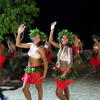
In April 2019 the Gambier Islands hosted a cultural festival. Singers, dancers, drummers came from all over French Polynesia and presented the differences between the Gambier, the Australes, the Tuamotus, the Societies and the Marquesas.
(60 photos)
2019
15
Apr
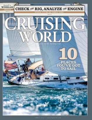
Penrhyn article in Cruising World April 2019
We have a few articles accepted for publication in the renowned Cruising World magazine, and the first one has now actually made it into the April issue. This one is about our stay in Penrhyn.
 Birgit Hackl, Christian Feldbauer: A Cook Islands Highlight, Cruising World, April 2019.
2019
13
Apr
Matapukurega Festival
There’s a 3 day long cultural festival going on in Rikitea at the moment. Groups from Hao (Tuamotus), Hiva Oa (Marquesas), Tubuai (Australes), Faaa (Tahiti) and even Rapa Nui (Easter Island) have arrived, events take place every evening and it’s great to see and hear the differences in their dances and choirs. The anchorage has filled up with boats, almost 30 are anchored here at the moment.
Unfortunately the weather’s not playing along. It’s blowing hard from the SE, the dancers are shivering while waiting for their performances and the cruisers watch in their foul-weather gear ![]() On the first day it was still sunny, yesterday cloudy and today it’s raining…
On the first day it was still sunny, yesterday cloudy and today it’s raining…


